


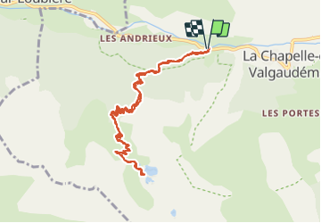
Lacs de Petarel et col de Petarel pour Arnaud (+37 mn!!!)

GOHIER
User

Length
11.8 km

Max alt
2108 m

Uphill gradient
1035 m
Km-Effort
26 km

Min alt
1069 m

Downhill gradient
1031 m
Boucle
Yes
Creation date :
2021-08-17 07:32:16.0
Updated on :
2021-08-17 16:25:43.313
8h52
Difficulty : Medium

FREE GPS app for hiking
 SityTrail
IGN / Geographical institutes
SityTrail Plus
The world is yours!
About
Trail Walking of 11.8 km to be discovered at Provence-Alpes-Côte d'Azur, Hautes-Alpes, La Chapelle-en-Valgaudémar. This trail is proposed by GOHIER.
Description
Magnifique et peu de monde.
Famille au complet 👍
Positioning
Country:
France
Region :
Provence-Alpes-Côte d'Azur
Department/Province :
Hautes-Alpes
Municipality :
La Chapelle-en-Valgaudémar
Location:
Unknown
Start:(Dec)
Start:(UTM)
277043 ; 4966711 (32T) N.
Comments